


Garmin Montana 710i GPS Handheld Satellite Communicator | inReach SOS

Garmin Montana 710i GPS Handheld Satellite Communicator | inReach SOS
Description
The Garmin Montana 710i brings together two pieces of essential outdoor equipment into one device: a capable GPS navigator and a satellite communicator. Whether you are travelling beyond mobile coverage or exploring unfamiliar terrain, it provides mapping, navigation, messaging, and emergency communication from a single handheld unit.
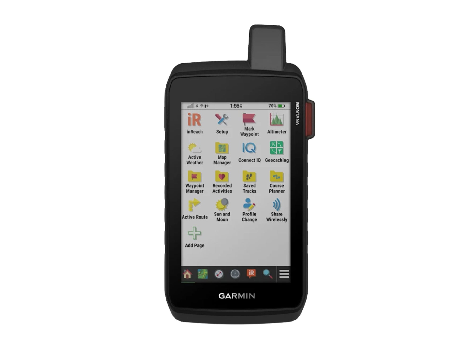
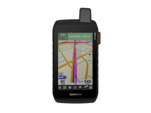
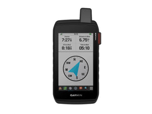
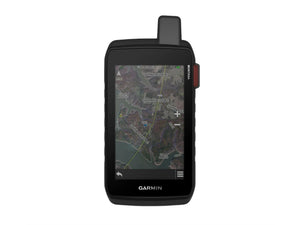
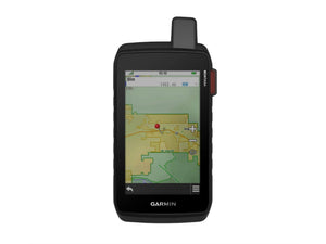
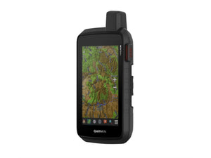
The large 5-inch touchscreen gives you plenty of map detail without becoming difficult to carry. Preloaded TopoActive maps, downloadable satellite imagery, and turn-by-turn road navigation help you move confidently between backcountry routes and vehicle travel. Multi-GNSS support and built-in ABC sensors provide additional navigation accuracy and environmental awareness when conditions become more demanding.
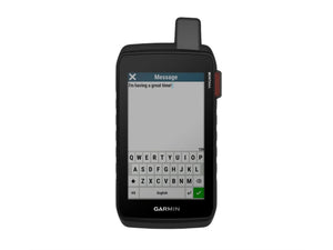
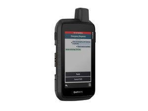
Where the Montana 710i really stands apart is its inReach capability. With an active subscription, you can exchange messages, share your location with family or friends, access weather updates, and trigger an interactive SOS alert to a 24/7 emergency response coordination centre if needed.
Battery life is designed for extended trips, with expedition mode providing exceptionally long runtime between charges. Remote places tend to reward preparation, and the Montana 710i is built for exactly those situations. A strong choice for adventurers who want reliable navigation and satellite communication in a single rugged handheld.
Key Features
- inReach Satellite Communication: Send and receive messages, share locations, and access interactive SOS alerts through the global Iridium satellite network with an active subscription.
- Large 5-Inch Touchscreen: Glove-friendly display provides clear mapping and navigation information in a durable handheld format.
- Preloaded TopoActive Mapping: Navigate using detailed topographic maps showing terrain contours, waterways, landmarks, and elevation data.
- Satellite Imagery Downloads: Access high-resolution satellite imagery directly on the device over Wi-Fi connectivity.
- Multi-GNSS Positioning: Uses GPS and Galileo satellite networks to improve tracking performance in challenging environments.
- ABC Sensors: Includes a barometric altimeter, weather-monitoring barometer, and 3-axis electronic compass for navigation support.
- New Zealand Street Navigation: Preloaded City Navigator mapping provides turn-by-turn guidance when travelling on roads.
- Expedition Mode: Ultra-low-power tracking mode extends battery life for extended off-grid journeys.
- Dog Tracking Compatibility: Pairs with compatible Garmin Astro and Alpha systems to assist with dog tracking in the field.
- Garmin Explore Integration: Plan routes, manage waypoints, review trips, and organise outdoor activities through the Garmin Explore ecosystem.
Specifications
Warranty
This product is covered by your rights under the New Zealand Consumer Guarantees Act.